Drone or Plane? Choosing Your Mapping Platform
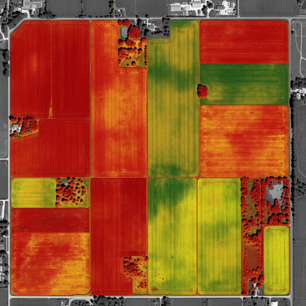
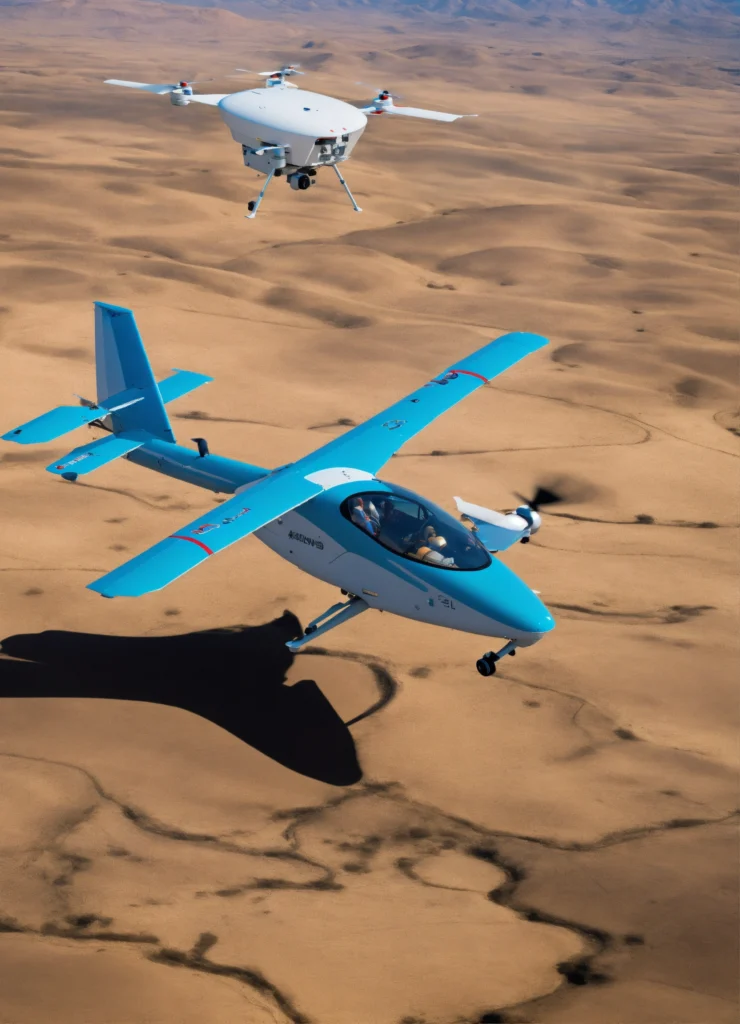
Drone vs. Manned Aircraft: Finding the Right Tool for Aerial Mapping In the world of aerial mapping and remote sensing, professionals frequently face a strategic question: should we deploy a drone or charter a manned aircraft? The answer, as with most technical decisions, depends entirely on the specific challenges and requirements of each project. Rather […]
Drone or Plane? Choosing Your Mapping Platform Read More »